

Wind power
Effect of wind farms on radar and navigation systems
The approval of new wind turbines near radar or air traffic navigation systems often creates conflicts that sometimes end up in court. It is undisputed that wind turbines can affect the signals of radar systems and omnidirectional range radio beacons. Up to now, there has been a lack of scientifically valid, reproducible investigations on the actual extent. Together with partners, the Physikalisch-Technische Bundesanstalt has developed a new measurement method and numerical simulation techniques for this purpose and published initial results.
Project context
Civil and military aircraft depend on reliably functioning navigation systems to ensure safe air traffic. Even in the age of satellite navigation, omnidirectional radio range beacons (CVOR, DVOR) are needed as back-up systems for satellite signals. Airspace surveillance is carried out with the aid of radar equipment. Furthermore, meteorological institutions also operate radar systems, for example to identify rain fronts or to measure the wind as a function of altitude (wind profiler). If wind turbines and wind farms are installed too close to these navigation or radar systems, they can affect their signals and thus the accuracy of the displays. Up to now, there has been insufficient data on the influencing factors and the actual extent of the interaction.
Research focus
The project is expected to provide the technical and scientific basis for a reliable forecast of the influence of wind turbines on radar or radio navigation systems. To this end, research teams are developing a measurement technology that allows them to record the time-dynamic change in electromagnetic wave propagation in the interference field of the plants. They then want to transfer these into a model of the electromagnetic transmission channel that is as simple as possible.
Results
The project partners have developed new measuring methods and measured the electromagnetic fields in the vicinity of wind turbines and navigation or radar systems. Dr Thorsten Schrader, project manager at PTB, explains: "We have achieved our goal of creating the metrological basis for recording the electromagnetic signal effects. The resolution of the high-end high-frequency measurement technology is at least two orders of magnitude better than, for example, the relevant target value of maximum angular error in the DVOR omnidirectional radio range beacon.
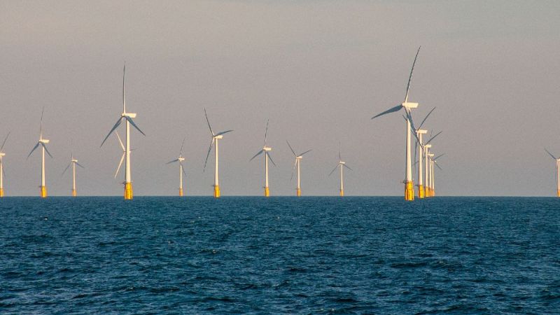
Measuring DVOR signals in the vicinity of wind farms
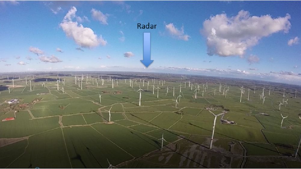
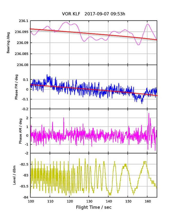
The measurements were carried out at various wind farms, including in the vicinity of omnidirectional radio range beacons (CVOR, DVOR). It was for instance possible to measure the signals of a DVOR situated eight kilometres away behind four large wind turbines (140 metres hub height, 112 metres rotor diameter). The signals were recorded during operation, shutdown, standstill and restart of the wind turbines. The researchers also specifically investigated the influence of nacelle orientation and rotor blade position on the signal content of the electromagnetic fields in the space. A second series of investigations on a wind farm with smaller turbines 2.5 kilometres away from a DVOR showed that the measured and simulated values for the angular error of the DVOR are qualitatively and quantitatively identical down to a few tenths of a degree. It was also proven that the measurement results are easily reproducible. This was the first time worldwide that the angle error caused by wind turbines at the DVOR could be determined metrologically. The evaluation of the measurement results obtained is expected to provide conclusions on the harmonised simulation models that should be applied.
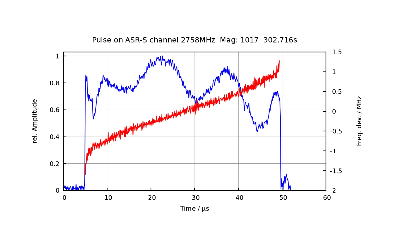
Further investigations dealt with the influence on radar signals of modern pulse compression radars. The focus was on the changes that a radar signal experiences on its way to the target through wind turbines.
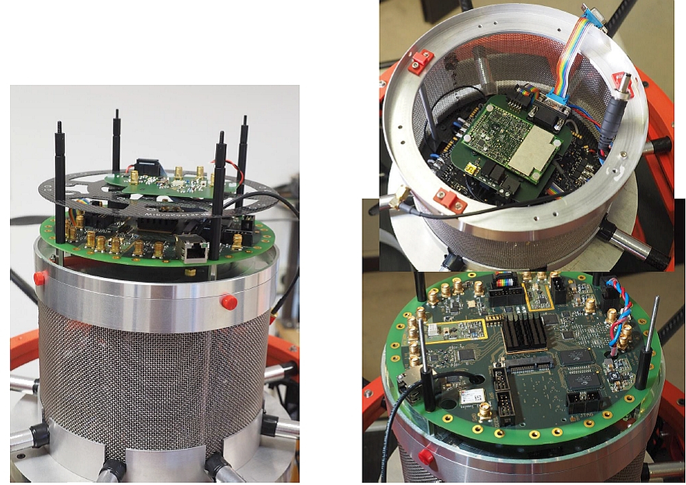
Measuring on site by drone
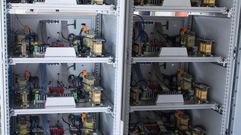
The high-frequency measurement technology was reduced in size to enable it to be flown on an octocopter. This allows investigations to be carried out in the vicinity of the wind farms, where it really counts. The drone is equipped with precision navigation and is controlled from the ground. The measurement technology captures, synchronises and stores the bandpass signals and the time and location information at a high data rate. This allows all movements and measuring points of the octocopter to be precisely specified and later traced. At the same time, a selection of the current measured data is transferred in real time to a tablet PC on the ground. There the measurements can be tracked and actively controlled.
This measurement concept with the drone has great advantages over previous measurement methods where the measurement technology was installed in aircraft and flown through these test tracks. The miniaturisation of the measurement technology means that the measurement system itself falsifies the data to a much lesser extent compared to an aircraft. The drone can remain in one point in space and record measured data over long periods of time. It can also fly at low speed within a wind farm and at lower altitudes, for example at the height of the rotor hub of a turbine. Additionally, the bandpass signal is recorded, which contains all information without preprocessing. For instance, both signal components (reference and directional circulating signal) can be determined separately in the DVOR and then evaluated. The entire measurement system, consisting of octocopter, antenna and measuring unit, is calibrated with feedback.
© PTB
© PTB

© PTB
© PTB
Innovation
In addition to measurement technology, the research partners have developed a powerful numerical simulation analysis. Comparing measured data and simulation results is essential in order to quantify the interactions between wind turbines and air traffic control or navigation systems. Measurements are taken of the electromagnetic fields in the airspace around the wind farms. To assess the interactions, only those parameters that can be obtained in measurements such as simulations may be taken into account. The project partners have developed a method that can measure the signal content available as signal-in-space for real signals from terrestrial navigation systems and radar systems on site.
Effects on the wind energy sector
Until now, wind turbines have had to maintain a safe distance from radio beacons and radar installations. In practice, this often causes conflicts that sometimes end up in court. The German Wind Energy Association surveyed its members on this topic in 2015. This revealed that wind projects of more than 4,120 megawatts are being blocked by existing concerns about flight safety and the operation of radar systems. With more than 2,333 megawatts of thwarted wind power, the protected areas with a radius of 15 kilometres around the omnidirectional radio range beacons of civil aviation (CVOR, DVOR) have been the biggest problem so far.
The measurement methods now developed by the project partners contribute to a more precise and scientifically valid specification of the areas to be protected in the approval processes for wind turbines in the vicinity of radar and navigation systems.
Last updated: 31.03.2018


.")
