Geothermal energy
GeotIS - geothermal information system supports planning
GeotIS provides companies and research institutions with a reliable database for assessing the feasibility of geothermal plants.
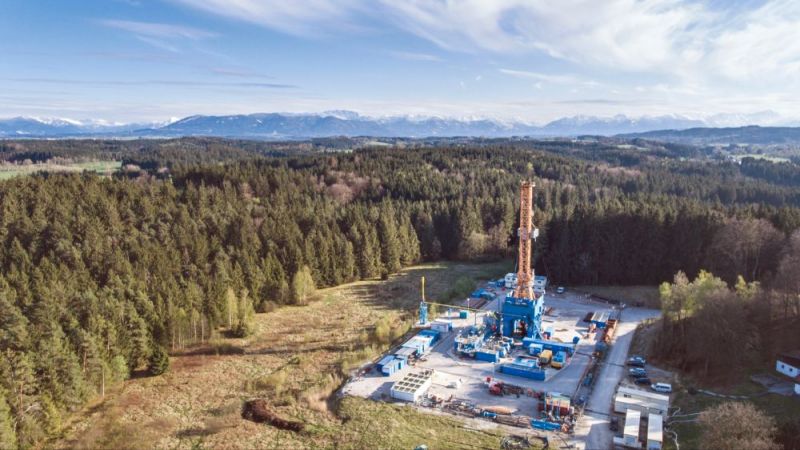
As a renewable heat source, deep geothermal energy is a promising alternative to fossil energy media such as natural gas or crude oil. Unlike other green energy sources, it is furthermore not affected by the weather or the seasons. However, there are significant differences in the geological conditions of potential locations. The greater the required drilling depth, the higher the costs and technical effort. In addition, substratum temperatures can vary from place to place. This is why the substratum must be explored using geophysical methods prior to any geothermal project.
5.8 million data sets for interested parties
For this purpose, the geothermal information system GeotIS provides reliable geological and geophysical information of the space underground in the form of images, maps and data sets free of charge via a website. Project developers will find helpful answers here, for example on the presence of geothermal reservoirs, the depth of the potential well or the temperature of the thermal water. This enables interested parties to assess whether thermal water can be extracted. In addition, public authorities and other stakeholders can use GeotIS for general questions of underground spatial planning. The interactive database is continuously updated, for instance by using data from all geothermal production facilities in Germany through annual operator queries and research projects from universities and institutes. GeotIS uses this database to calculate and provide energy statistics on geothermal installed output in Germany. Altogether, GeotIS as a digital infrastructure offers around 5.8 million data sets and 34 gigabytes of data.
GeotIS was developed by the Leibniz Institute for Applied Geophysics (LIAG) as part of a research project funded by the German Federal Ministry for Economic Affairs and Energy (BMWi) and has been in operation ever since. The portal has been online since 2007 and has been further developed and expanded in the course of several follow-up projects. In 2020, an e-learning tool on deep geothermal energy was also integrated on the website. Since the new Geological Data Act came into force, the re-evaluation of data from commercial exploration using artificial intelligence methods is a future task for the information system, so that added value can be generated from inventory data and made available for use.
5 March - Day of the European Surveyor and GeoInformation
The Day of the European Surveyor was created on the occasion of the 500th birthday of Gerhard Mercator. The cartographer became world-famous in the 16th century with his large world map. He succeeded in representing the globe in the form of a two-dimensional map with his Mercator projection.