Wind power
Reliable data for weather radars around wind turbines
When wind turbines are built too close to weather radars, data gaps occur for weather forecasting - a problem especially during storms. In the RIWER research project, scientists have developed measurement and analysis methods to address this problem. The German Weather Service (DWD) is now testing the algorithms from the Neubrandenburg University of Applied Sciences with measurements from its weather radar systems.
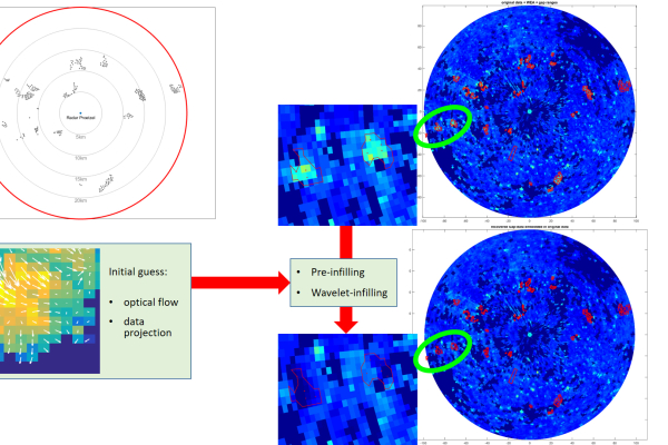
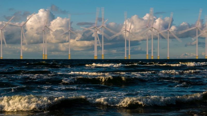
Wind turbines near weather radars reflect radar radiation. This usually generates considerable interfering signals that make it difficult to observe the weather. So far, the only approach is not to use the entire echo signal in the area of the wind turbines due to the considerable amount of interference - however, this results in data gaps over a wide area. The algorithms of the Neubrandenburg University of Applied Sciences are now used to reconstruct these data gaps for radar reflectivity retrospectively in a temporal and spatial neighbourhood. They incorporate the weather observations in the process. In special, simple cases, the algorithms filter out the interference components of the wind turbines in the radar data. This means that reliable weather forecasts are also possible for areas with wind farm sites.
New algorithm delivers good results for different weather scenarios
The algorithm reconstructs the interior of the radar reflectivity data gaps using an iterative method. Global and local radar measurements around the wind turbines and the temporal course of previous weather events are incorporated into the calculations. However, this method is limited - if the region influenced by the wind farm is too large or if there are too few unaffected radar measurements in the vicinity, the reconstruction method is no longer sufficiently precise. The DWD has already created a test environment and interface for the algorithm for its radar processing chain. The use of the method at the radar sites in Prötzel and Memmingen has shown good results so far - at least with no or only light rain.
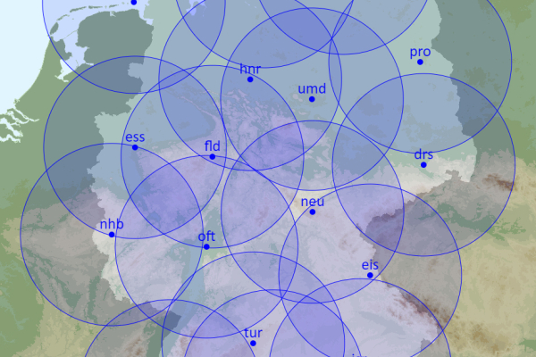
The methods that have now been developed still need to be extensively evaluated. The meteorologists are now planning to test the results for as many different weather situations as possible and adjust them precisely. All radar sites in Germany are included in their considerations. They also assess the impact on the DWD's warning methods..
In addition to radar reflectivity, other radar measurements are available from the DWD's modern weather radar systems, so-called Doppler and especially polarimetric radar measurements. These are also of fundamental importance for the work of the DWD, which is why further development work will be required in the future.
Background: Why are the weather radar data disrupted by wind turbines?
Weather radar is the only measurement method that records precipitation over a wide area and in three dimensions. This means that it is crucial especially for the DWD's warning management. The rotating weather radar antenna sends electromagnetic waves into the atmosphere, which are scattered by the precipitation particles. The signal then received by the weather radar corresponds to the sum of the echoes of all particles located in a given volume. In addition to precipitation particles, this volume can also contain other, non-meteorological objects - for example buildings, mountains or wind turbines. Echoes from the moving rotor blades of wind turbines are superimposed on the weather signal and, unlike echoes from stationary buildings or mountains, cannot be separated. Therefore, they look like (very) heavy precipitation in the data.
Alternative measurement methods improve understanding of radar echoes from wind turbines and raindrops
Another way of gaining a better understanding of the backscatter behaviour of wind turbines is being developed by Chemnitz University of Technology (TUC) and the Physikalisch-Technische Bundesanstalt (PTB). As part of the RIWER research project, the project partners use measurement and analysis methods to obtain the radar signature of the wind turbines directly on site and from different angles. To do this, the researchers used an octocopter near the Hanover weather radar, which could fly close to a spinning wind turbine. This enabled them to investigate the backscatter characteristics in more detail. The work has not yet been completed and the data have not yet been fully evaluated. But the potentials are recognisable.
For example, with the so-called differential reflectivity. This display method combines horizontally and vertically polarised radar signals. This value has a special appearance in rain; wind turbines produce different signals. The researchers see a further focal area on the effects of multipath wave propagation. This occurs when several wind turbines are located in close proximity to each other. Radar signals are not only reflected directly back to the radar, but are also scattered in other directions, hit adjacent plants, are scattered again and only then reach the radar unit. The scientists made interesting observations in this context during rainy weather conditions. This, too, may have the potential for methods to distinguish weather signals more clearly from those of wind turbines. (mb)

